Repairing Gully Erosion
The Tenmile Creek pilot project has as a goal to identify gully erosion sites throughout the Tenmile Creek watershed, to work with land owners, and to seek resources in the future to stabilize and heal gullies. Gullies are like small trenches on hillslopes eroded by water and through which water flows during and after storm events. They often form on unarmored hillslopes when water is deflected into a new path and can enlarge and erode headward, sometimes forming very large features. Gullies can deliver significant amounts of sediment pollution to streams. They can also drop the water table in the surrounding meadow or forest, which means less available water for plants.
Gullies often form downstream of roads so we will be examining road stream crossings throughout the watershed. Old logging roads can fail and cause gullies decades after they are abandoned. Such features may be masked by maturing forests. Healing gullies usually involves deflecting water that is causing erosion and filling the gully with brush or building check dams. Services are still available by calling Philip Buehler of BioEngineering Associates at (707) 513-6010.
The eastern portion of the Tenmile Creek watershed is underlaid by the Central-belt Franciscan Formation and tends to have many meadows and grasslands. Gullies can form easily where roads cross grasslands, since ditch relief culverts often discharge on unarmored areas because there is little rocky material in the soil.
This is Anna Birkas in a meadow gully near Cahto Creek on the Verhagen Ranch. Old road drainage caused the gully, which has endured even after the road was abandoned. This feature could be healed with brush mattresses and/or possible willow sprigging.
Pat Higgins shows the height of the terrace caused by sediment discharge from a gully on the Vassar property that is thought to be initiated by a road system upslope.
An old gully formed by logging road failure decades ago in lower Tenmile Creek on the Hrabek property. The gully is no longer actively down-cutting and is healing, as evidenced by small trees and brush taking root on the gully walls and in the channel.
This map shows the Tenmile Creek watershed locations where roads cross streams. Improperly installed culverts can cause gullies to form below roads. The ERRP team will travel all roads possible in the watershed and collect data at stream crossings. If ditch relief culverts are spaced too far apart, they may cause gullies, so we’ll also inspect culvert spacing during our surveys.
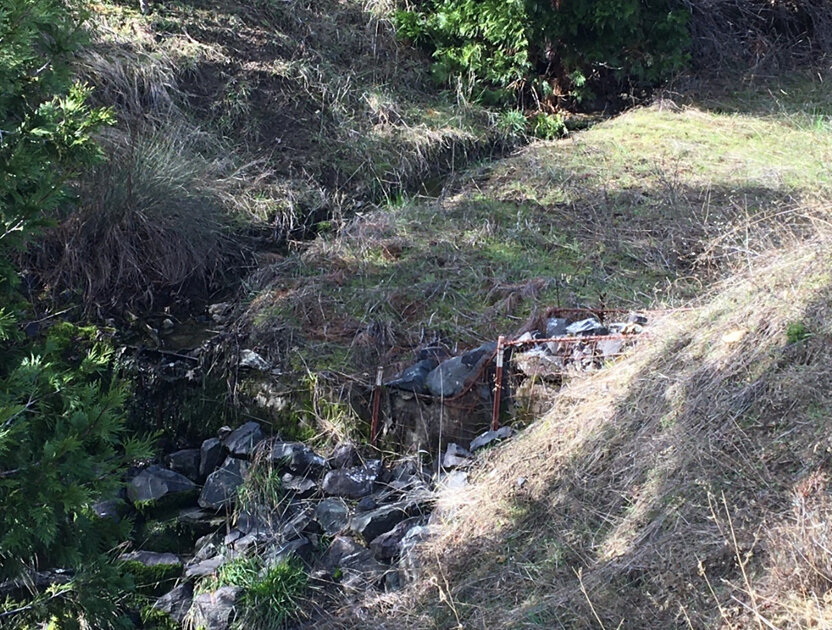
This photo shows a treated gully that was so significant in size that a check dam was built from hog wire fence and rock in the early 1990s. The hump upstream of the wire is deposited sediment. The gully was completely healed.


