Tenmile Creek Flow Videos
The State Coastal Conservancy Prop 1 funded Tenmile Creek Water Conservation and Erosion Control Project (Agreement # 20-076) included resources for placing timelapse cameras throughout the watershed. Since 2018, the cameras have taken photos every half hour during daytime. We make movies out of the still photos and post these flow videos to our Vimeo page. Narration includes context for understanding climate cycles and how native fish runs are coping with the changing climate. If we work together to “slow it, spread it, and sink it”, the flow movies captured by future generations may be different. Thinning the forests, reviving oak woodlands, and restoring the hydrology of grasslands could all positively influence baseflow. This year we lost cameras to vandalism or theft, and three to flood effects. Nonetheless, we captured vital information about flow for Tenmile reaches and tributaries. Here are the videos that were posted for the project. Check them out!
Tenmile Creek Flow Videos 2020-2024
Lower Tenmile 7/19/2020 to 1/30/2022
Low Mid Tenmile 6/30/2020 to 11/15/2021
Streeter Creek 6/3/2020 to 2/24/2021
Big Rock Creek 5/11/2021 to 11/15/21
Upper Mill Creek 6/13/2021 to 10/13/2021
Peterson Creek 6/15/2021 to 11/15/2021
Elder Creek Sept 2021 to Aug 2022
Big Rock Creek Nov 2021-to Jan 2023
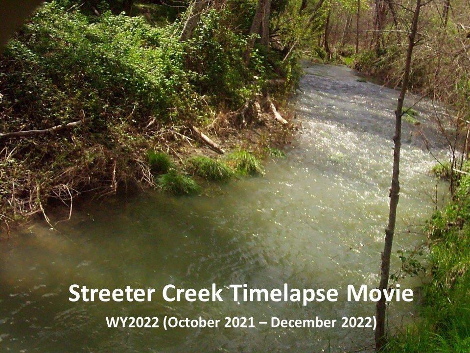
Streeter Creek Oct 2021 to Dec 2022
Upper Mill Creek Sept 2021 to Jan 2023
Mill US Little Case Sept 2021 to Jan 2023
Cahto Kvaka Dec 2021 to Oct 2022
Low-Mid Tenmile Creek Dec 2021 to Oct 2022
Lower Tenmile Feb 2022 to June 2022
Peterson Creek Nov-Dec 2022
Lower Tenmile Creek 8/4/23 to 1/24/24
Tenmile Vassar 10/28/23 to 7/15/24
Upper Mill Creek 10/9/23 to 5/31/24
Cahto Creek - Boulle 4/24/23 to 6/16/24
Lower Big Rock Creek 10/28/23 to 7/15/24
Elder Creek 8/27/22 to 6/14/23
SF Eel at S. Leggett 10/2/22 to 7/22/23
NF Eel at Azbill Creek 7/26/20 to 8/11/21
Tenmile US Peterson 11/7/22 to 12/26/22
We also have timelapse videos from 2018, 2019 and 2020. See them here.
Upper Mill Creek off the Cahto Peak Road is a salmonid refugia that usually has perennial cold water, but in September 2021 you'll see the video starts with a dry creek bed because WY 2021 was the 2nd driest year in CA history. Camera malfunction omits the 10/24/21 flow event, but robust flows in through January 2022 show plenty of water for coho salmon to ride. Juvenile coho were found here in September 2022. The cool thing about this video is how overland flow is evident, as the tributary in the frame springs to life with rain. The December 2022 and early January 2023 flows are impressive. Watch
Check out video of coho salmon at this location in September 2022
Lower Big Rock Creek: Camera malfunction kept us from capturing the October 24, 2021 storm early in WY 2022, but the Big Rock timelapse camera caught everything after that through January 2023. High flows in December 2021 and January 2022 were followed by a record dry period during March and unusually high flows in mid-April that revived stream flow. Big Rock lost surface flow from August through October 2022, then intense rain in December 2022 and January 2023 made for some dramatic shots. Watch
Tenmile Creek at Vassar’s – Above Grub Creek, and downstream of Hwy 101 lies a highly productive reach of Tenmile Creek. Watch the creek surge in December 2021 and early January 2022, which allowed great disbursal for spawning of Chinook and coho salmon. Super dry conditions from late January to March 2022 dropped flows way down, but unusual mid-April rains revived flow. Small spates from May through June kept conditions ideal for salmonid rearing. Later in summer 2022, Tenmile Creek lost surface flow. High flow photos of Tenmile Creek in December 2022 and January 2023 have not yet been downloaded yet because we couldn’t get to the camera. Flows are abating and new images coming soon. Watch
Elder Creek is not within the Tenmile Creek watershed. We operate a timelapse camera there because its watershed is a similar size, but has been managed differently. It serves as our control stream. Footage from September 2021 show Elder maintaining flow when most Tenmile tribs were dry. The 10/24/21 storm and subsequent high flows in November-December allowed coho salmon dispersal. A dry period from late January through March inhibited steelhead spawning migration, resulting in lots of coho and low steelhead densities in August 2022 when we did a dive check. Watch
Video of juvenile coho salmon in Elder Creek in late August 2022
Mill Creek at Joe and Mara’s: This camera is at Joe Feigon and Mara Kimmel's place on Mill Creek above Little Case Creek. Camera glitch prevented capture of 10/24/21 rain event, but video from December 2021 to October 2022 captured the full range of WY 2022 flows. Plenty of water for coho in December 2021 and early January 2022, then super dry during steelhead spawning season from January-March 2022. Timely but unusual rain in mid-April and small spates through early July sustained flows. At the end of August, Mill Creek almost disconnected, but came back to life as nights cooled in September, trees shut down, and a small storm revived flows. Coho salmon juveniles were able to survive just downstream of the camera location. Floods in December 2022 and early January 2023 washed away the camera and the tree it was on. Live flow clip from Mara gives you a feel for the power of water. Watch
Check out coho juveniles rearing just below eroding bank site in September 2022:
Cahto Creek at Dan & Deb’s: The camera on Cahto Creek off Mulligan Road is on the property of Dan and Deb Kvaka and unfortunately it washed away in late December 2022. However, some fun and useful imagery was captured between 12/3/21 and 10/16/22. Coho juveniles were found upstream on Cahto Creek Ranch in September 2022. Flows sufficient for their spawning migration were evident in December 2021 and January 2022. The driest January-March period on record occured in early 2022, but was followed by lucky mid-April rains. Cahto Creek disconnected at this location in early August and was still dry in mid-October. Flows have been fantastic for coho migration, and we are scrambling to get a camera back up. Watch
Streeter Creek at Black Oak Ranch: Dry in September 2021, the 2nd driest year in California history, this video then captures unusual rain of October 24, 2021. Plenty of water for Chinook and coho salmon spawning through early January 2022, then super dry until April 2022 rains. The flow disconnected in August, and began to reconnect in October, and then flows peaked in late December 2022. The Streeter Creek camera was washed away by flood waters, but ruined camera was retrieved and some photos salvaged from the memory chip. Despite disconnected flow in late summer/fall 2022, just upstream on the Black Oak Ranch there were isolated cold pools that supported juvenile steelhead rearing. Watch
Check out video of steelhead and Chinook feeding in lower Streeter Creek in May 2022
Lower Tenmile Creek: This camera is just upstream of the South Fork Eel River in the wildest part of the Tenmile Creek watershed. Camera malfunction resulted in no early WY 2022 images, so flow shots were captured from 1/30/22 to 6/23/22, when the camera strap broke. This camera has problems with fog on the lens, but the unusual mid-April 2022 rains are captured. Should have some good stuff from late 2022 and early 2023 when we retrieve soon. Watch
Peterson Creek: This is a super important lower Tenmile Creek tributary that has perennial flow and water temperature supportive of salmonids. This is a short timelapse movie from Nov-Dec 2022. The placement of the timelapse camera in Peterson Creek is unusual in that it is very close to the water surface. As a result, the camera was submerged by high flows and the last frames are of brown water after which the camera quit functioning. Watch
Check out WY 2021 timelapse of Peterson Creek, which is one of the clearest illustrations of evapotranspiration that you could have:


