Modeling & Water Budget
As part of the SCC Prop 1 Phase II, Thomas Gast Associates Environmental Consultants adapted the Salmonids Across the Landscape SAL model because eco-hydrologic modelling can help stream restoration practitioners identify the factors driving streamflow depletion. SAL is based on peer-reviewed hydrologic equations and combines two model types with grid coverage and a vector model of channel flow. The model was applied to the Cahto Creek and Mill Creek watersheds.
Thomas Gast Associates Environmental Consultants (TGAEC). 2024b. Modelling Streamflow in the Mill and Cahto Creek Watersheds. May 15, 2024. Authors Julia Petreshen and Dr. James Graham. Performed under contract to the Eel River Recovery Project Eel River Recovery Project SCC Prop. 1, Phase II (Agreement # 20-076. TGAEC, Arcata, CA. 37 p.
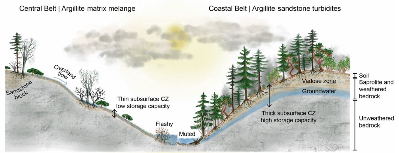
Watershed water storage in Coastal Belt versus Central Belt. From Dralle et al. (2023).
Drawing on other local hyrdrologic research, the report points out baseflows in both Cahto and Mill Creek are a product of varying bedrock geology, with Coastal Belt to the west being water bearing and the Central Belf Mélange to the east having very poor storage and groundwater availability. This is also similar to the findings of a previous USGS groundwater study (Ferrera 1986). The TGAEC modeling report points out that poor groundwater supply in much of both the Mill and Cahto Creek watersheds suggests that augmented storage and rainwater catchment are needed to supplement the water supply without ecological degradation. Their findings are that current over-stocked forest conditions in both watershed is depleting flow by 20%-38%, so forest health thinning will help restore baseflows.


